Colorado is assumed to have incredible mountain biking, and it truly does. Fruita, Crested Butte, Eagle, Snowmass, Steamboat, and many other lesser-known areas offer untold miles of singletrack. Despite Boulder’s fame as a cycling center for roadies, the Western Slope has much to offer, with expansive views and low traffic loads.
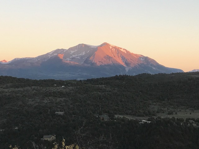
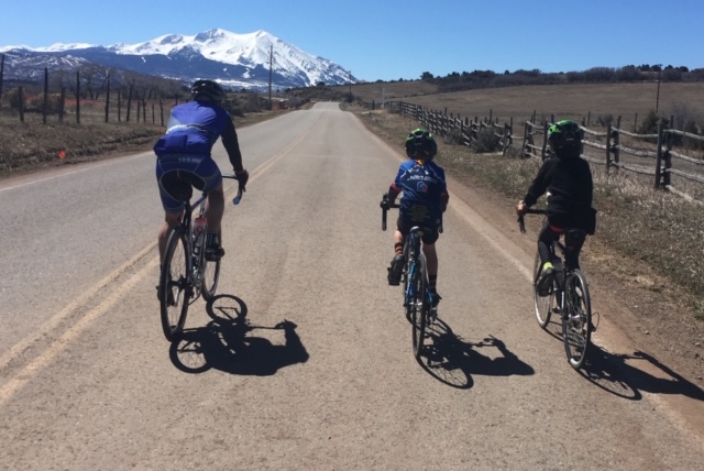
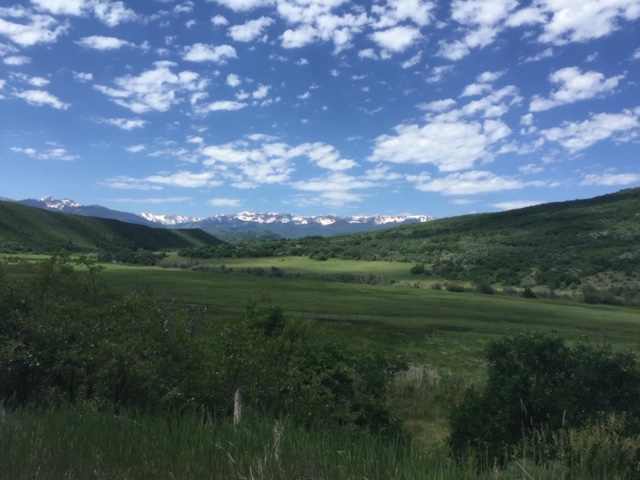
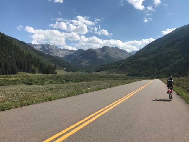
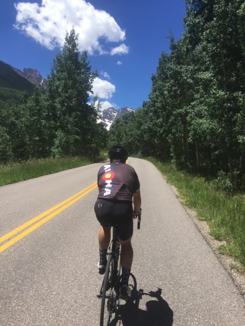
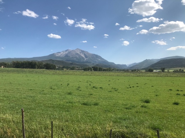
The Roaring Fork Valley, home to Aspen, Snowmass, and Glenwood Springs, has a rich history of road cycling. Upvalley rides such as Maroon Bells and Castle Creek, as well as Independence Pass, are well known. However, the mid- and lower valley offer more miles of quiet roads and longer shoulder seasons.
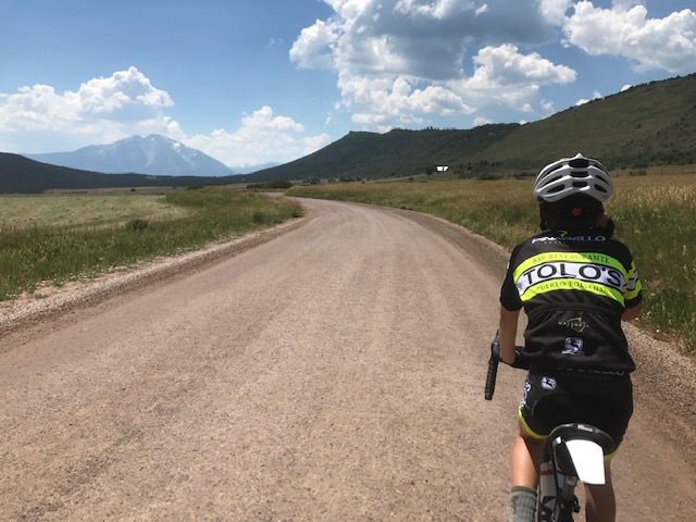
Many of these rides are easily accessible from the center of Carbondale without needing a car. Most of the rides listed below start at La Fontana Plaza at 500 Highway 133, home to Aloha Mountain Cyclery and Dos Gringos (food and coffee), and finish in the center of Carbondale at 4th and Main. The start and finish are about 1/2 mile apart and both offer parking.
Carbondale’s Main Street offers restaurants, galleries, shopping, a brewery, a distillery, and swimming pool, as well as some nice parks. The center of town is small and inviting, and it’s a great place to relax and unwind after a ride. The First Friday of every month is a celebration of gallery openings, conversation, and celebration of the end of the week.
These rides are at high altitude, ranging from 4,000’ at the low end, and topping out at Independence Pass, at 12,095′. Hydration is extremely important, as summer humidity levels can be as low as 12%. Please start hydrating at least 2 weeks before arriving. In our dry climate, you can aspirate 750mL of water per day. You can replace this by consuming a 5th of your favorite booze, or slug down some beer, but The Mamil recommends water, or at least a few ice cubes in your cocktail.
Colorado weather can be fickle, and a 50*F temperature swing is not unheard of, so plan accordingly. Monsoon Season can have aggressive afternoon thundershowers, sometimes with hail or snow. Plan on a gilet and/or wind jacket when climbing higher routes, particularly the big passes like Independence, Fremont, and Vail.
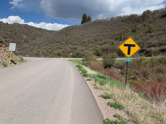
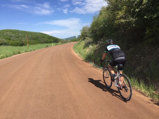
Colorado roads tend to not be too steep or twisty, although there are some exceptions to every rule. Unlike the 15% grades in the Alps, Colorado’s mountain roads are generally lower angle, as many were originally built for mining railroads or horse-drawn ore wagons. Trains can’t do tight switchbacks, so turns are usually sweeping, and thanks to CDOT’s road engineers, horribly off-camber. Often, this means you can see the top of the pass for a disturbingly long time as you approach it on the climb, or conversely, you can see the valley bottom as you shoot off into space from a poorly-canted turn while descending. You may also hear locals refer to ‘The Switchback’, and everyone knows exactly where that is.
Rio Grande Trail
The Rio Grande Trail starts in Glenwood Springs at Two Rivers Park, and heads south to Aspen, about 50 miles. It connects to the Glenwood Canyon Bike Path, which will soon connect all the way to Lake Dillon (some small sections are under construction between Wolcott and Eagle). Eventually, it will also continue westward through South Canyon, offering a bikeway from Summit County to the Grand Mesa.
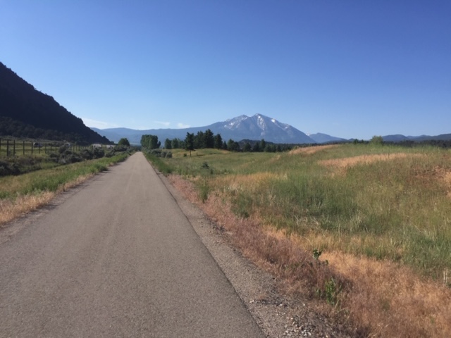
The Rio Grande Trail is a former railbed, so it never exceeds 3%. It acts as a recreation corridor through the Roaring Fork Valley and has been used several times in Ride the Rockies and Tour of Colorado. The trail goes through Carbondale, El Jebel/Willits, Basalt, Snowmass Canyon, Woody Creek, and Aspen, with a spur to Brush Creek and New Snowmass. It offers easy access to cycling, hiking, fishing, and can at times be crowded with people and animals (including wildlife). Share the trail and be courteous to other users.
Many of the routes listed here use the trail to connect roads and loops, but the trail is also a great out-and-back itself. Spur road routes such as Lenado (from Woody Creek) and Brush Creek (New Snowmass), Old Snowmass, Emma, Hooks Spur, El Jebel, Catherine Store, Highway 133, Cattle Creek, CMC/Thunder River, and Red Canyon all allow opportunities to leave and rejoin the trail to create loops.
Missouri Heights
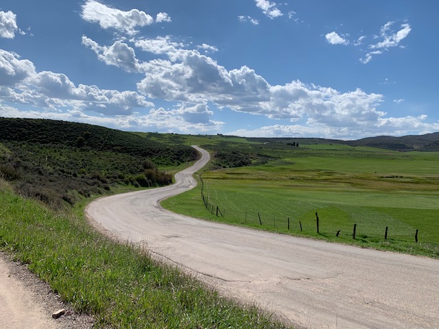
North of Carbondale and east towards El Jebel is a large bench offering multiple loops and routes (see Cattle Creek Loop). Missouri Heights is covered in a loose grid of roads, and it’s easy to make circuits of varying sizes, up to a full century ride. Most offer a gas station or convenience store at the intersection of Highway 82, and all but one (Red Canyon) offer a light or tunnel to cross the highway. Each variant can be ridden in either direction.

Cattle Creek Loop for .gpx, right-click and save link as… here
20 miles, 1300’. Starting at Aloha, head north to the traffic light and cross to the RFTA park and ride, then pick up the Rio Grande Trail towards Glenwood for about 4 miles. After crossing a wooden bridge, there is a gate to cross Highway 82. However, instead of crossing, take a small singletrack back southwards to a tunnel under the Highway. Exiting the tunnel, turn left to rejoin Cattle Creek/CountyRoad 113. Follow Cattle Creek for 7miles, climbing gently through ranches. There is a climb at about mile 4.5, with ramps up to 9%, then it flattens to a T-intersection. Turn right and climb the short Cattleberg ramp.
Once cresting the hill, you are greeted with views of the Elk Range. Stay on this road for 3 miles and descend Catherine Store to the traffic light at Highway 82. Cross the highway, and stay on the road until you go over the bridge. A sharp left onto the Rio Grande Trail, then right (westward) 3 miles will bring you back to Carbondale. Main Street has sharrows painted, so feel free to ride in the lane to the center of town at 4th Street.

This route works equally in either direction, although Catherine Store hill has ramps at 9% and is a more challenging climb than Cattle Creek.
Red Canyon and Missouri Heights intersection options
Red Canyon Big Loop for .gpx, right-click and save link as… here
Red Canyon Medium Loop for .gpx, right-click and save link as… here
From Aloha, follow the Rio Grande Trail north towards Glenwood Springs. Continue past Thunder River (stoplight), then the crossing at County Road 154. A mile further down the trail, there is a small crossing, opposite Red Canyon. Turn right here, then CAREFULLY cross Highway 82. There is no pedestrian crossing here, and no light. Be patient and wait for a gap, this is a dangerous intersection.
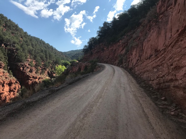
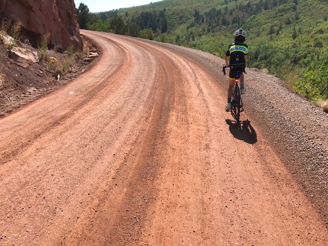
The main road goes through a light industrial group of buildings, and climbs immediately. About 100 feet past the switchback, the surface turns to gravel. Durable road tires are fine. The road gets narrow along the first 1/2 mile, down to one lane. Keep a watchful eye for traffic. Once past the cliffside roadcut, the road widens and winds upwards at a steady 5-8%. A final kick up an 11% ramp brings you to the first crest, and the surface returns to pavement.
From here, Red Canyon Road rolls along with expansive views of the Elk Range. The first intersection, a Y, offers 2 options: turn right onto County Road 114 (CMC/Thunder River) and descend down to Highway 82. Refill bottles at the Thunder River Market, cross 82 at the light, and rejoin the Rio Grande Trail.
If you proceed left, more climbing awaits, with 4 ramps to the top. Once you crest out, you descend into Coulter Creek, with about 2 miles to a sharp hairpin to the right at the old schoolhouse. Just past the schoolhouse is another Y intersection.
Staying straight at the Y takes you to Cattle Creek’s T intersection, where you can go right to descend Cattle Creek to 82 (there is a tunnel about 100’ to the left/south of the road crossing), or go straight to climb to the top of Catherine Store Road/ County Road 109. As you descend from the top, you come to yet another Y: go straight to Catherine Store, or left to Fender Lane. At the end of Fender, turn right to descend El Jebel Hill.
Back at the Y-intersection just past the Coulter Creek Schoolhouse, turn left to head towards Cottonwood Pass and Spring Park reservoir. Shortly past the Cottonwood Pass turn, the road surface returns to gravel. Again, durable road tires are fine. Excellent views of Basalt Mountain. There is one short ramp, then a right turn. Keep an eye out for cattle, this can be open range at times. Once you sweep right, the road continues with the reservoir on your left.

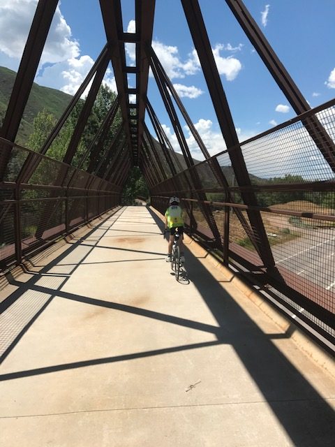
Eventually the pavement returns, then you descend El Jebel hill. This is not a technical descent, but it can get fast and there is an S-turn with odd camber, so keep your eyes out. At the bottom of the hill is another intersection with Highway 82. To the left of the intersection as you approach, there is a pedestrian tunnel. Upon exiting the tunnel proceed left past City Market and into Willits for a snack or drink, or continue down Willits Lane 1 mile to Hooks Spur Bridge. Turn right and cross the bridge, then right again onto the Rio Grande Trail to return to Carbondale.
CMC/Thunder River
CMC Loop 1 for .gpx, right-click and save link as… here
CME Loop 2 for .gpx, right-click and save link as… here
26 miles, 2100′, or 35 miles, 2600′. Like Red Canyon, this climb offers access to all of Missouri Heights. It has a safe intersection at Highway 82 with a crosswalk and pedestrian buttons at the light. From Aloha, follow the Rio Grande Trail 5 miles towards Glenwood Springs. At the first stoplight you encounter, cross 82 and begin climbing. There are a couple of ramps up to 8%, but generally the climb is steady and 4-6%. Pass Colorado Mountain College’s campus and Colorado Animal Rescue, then continue past Rivendell Sod Farm. Above Rivendell, you come to a Y-intersection: left takes you to Red Canyon and back to 82; right takes you to Coulter Creek and El Jebel. All of the other intersection options are listed above.
Emma-Roubaix
Emma-Roubaix .gpx, right-click and save link as… here
Emma-Roubaix-Snowmass .gpx, right-click and save link as… here
33 miles, 1450’, or 58 miles, 3500′. Mixed surface (sturdy road tires are fine). Park at Aloha, get an espresso at Dos, and head out onto the Rio Grande Trail behind the building to the east (right). You will follow the Roaring Fork River, though the Rock Bottom section (seasonal closures). Keep an eye peeled for wildlife (bears, foxes, coyotes, cougars, and fly fisherfolk) and birds (golden and bald eagles, ospreys, large gnats). Stay on the trail about 10 miles to Emma, where an old schoolhouse sits by the side of Highway 82. Leave the RGT, and turn left onto the frontage road to pass the schoolhouse. Stay on West Sopris Creek road for about 2 miles, then turn left onto East Sopris Creek. There are several short, steep ramps to wake up your legs as you head towards the base of Mt. Sopris.
The road sweeps left and the pavement ends. As with all roadbase, you may find it in perfect condition and smoother than the pavement, or it may be washboarded and loose. Climb for about 2 miles, and crest where the power lines meet the roadway. From here, its a gentle ride with wide spanning views of the Elk Range and Capitol Peak. The roadbase will end, changing back to pavement for a fast, straight descent. At the intersection, go left, then left again, to go down Old Snowmass Creek towards Highway 82.
To add miles and some climbing, you can turn right and follow the road up Capitol Creek to the Monastery, then turn around. This road climbs gently, rolling past tall willows and ranches. Return to the T-intersection and turn left down the canyon.
(To extend the ride to 58 miles and 3500′, pass the T intersection and continue 8 miles to the Campground base of Snowmass Ski Area. Climb the ski area service road, then descend into Snowmass Village for restaurants and shops. After recharging, continue down Brush Creek to Highway 82. Cross the highway at the pedestrian tunnel at the right side of the light. At the north (left) end of the parking lot, the Rio Grande Trail restarts. Follow it to Woody Creek, and then the trail takes you towards Carbondale.) if you stop at the Woody Creek Tavern, it’s cash only. They usually have a water cooler outside for cyclists.
At the end of Old Snowmass Creek Road, there is a convenience store where you can refill and get a snack. Cross Highway 82 and take an immediate left to rejoin the Rio Grande Trail and return to Carbondale, about 15 miles.
Old Snowmass-Krabloonik-New Snowmass Loop
Long Version .gpx, right-click and save file as… here
Short Version .gpx, right-click and save link as… here
38-80 miles, 3000’-6800’. Either as an extension of Emma-Roubaix or as its own loop, this route offers beautiful views, climbing, and extensions to Maroon Bells and Castle Creek. Drive to the RFTA Old Snowmass Park and Ride, then, uh, park. And ride. Your bike, not the bus.

Go up Old Snowmass Creek about 2 miles, then turn left. After a bit over 7 miles, the pavement ends and you are back on roadbase. Durable road tires are generally suitable; knobs are not needed. The road continues to Campground, and a mixed surface service road through the ski area. The climb starts easy, under aspen trees, and gradually steepens, maxing at about 16% before cresting at Krabloonik. From here, you descend to Snowmass Village, where there are restaurants, bars, and stores.
After leaving the village, you can turn right on Owl Creek Road, then climb over Owl Creek divide. This will take you to Buttermilk and the Aspen Airport. Cross Highway 82 using the bike path tunnel at the end of the runway, then turn right towards Aspen. At the first road crossing, go back under 82 towards Tiehack. At the base of the lift, cross the bridge and turn right to for the 8 mile out-and-back climb up to Maroon Bells.
After the Bells, you can add another beautiful out-and-back of 26 miles. Follow the bike path and signs towards Aspen, then turn right towards the hospital. The ride up Castle Creek is beautiful, with some steep ramps and steady grades. A mile-wide avalanche in early 2019 dramatically changed this valley’s serene forests into a jumble of logs and debris. Continue past the town of Ashcroft, then keep going to the Pearl Pass trailhead and end of the pavement. After soaking in some views, it’s a fast, fun, non-technical descent to the Aspen Open Space.
From both the Bells and Ashcroft, you pick up the Rio Grande Trail. Cross the Open Space and follow the path to Cemetery lane. Though there are many trails across this area, they are well-signed. Stay on this path for a mile, then turn right after crossing the river to pick up the Rio Grande Trail and about 15 miles to the park and ride.
Westbank Loop for .gpx, right-click and save file as… here
14 miles, 470′. Another loop which can be ridden in either direction, this route follows the valley floor between Carbondale and Glenwood. Starting at Aloha, cross Highway 133, and join the Rio Grande Trail. Follow towards Glenwood about 5 miles to the Thunder River stoplight, then turn left onto County Road 154. Follow the road about a mile to a T-intersection, then cross the Roaring Fork River to the left onto County Road 109. The road will climb to Ironbridge Golf Course, then roll along the base of the ridge, offering views of Mt. Sopris. Stay on this road back to Carbondale, again crossing the river at the next bridge you encounter. Follow this road to the roundabout at Main and Highway 133, then continue to the center of Carbondale.
Dry Park
Dry Park Loop .gpx, right-click and save link as… here
24 miles, 1600′. An extension/variant of Westbank, with some Champagne Gravel and magnificent views of Mt. Sopris, this loop offers several stair-step ramps and traverses through ranches. From Carbondale, head towards Glenwood Springs on the Rio Grande Trail. Continue past CMC/Thunder River (where Westbank Loop turns left and leaves the path) another 3 miles to Buffalo Valley, the next place where the trail crosses a stoplight. Go left onto the frontage road for about a mile, then left again to cross the pedestrian bridge. This turn is not well marked, its across from the cemetery as the road starts to turn right. After the bridge, merge onto Midland Avenue for 1/2 mile. Then turn right onto 4 Mile Road. Stay on 4 Mile for 2 miles, until you see the billboard sign for Sunlight Mountain, then turn left onto Dry Park Road.
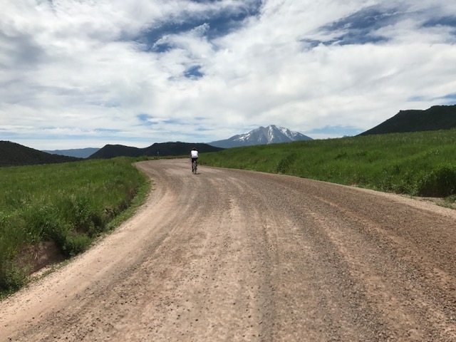
After 1/2 mile, the road turns to gravel. Stay on Dry Park for 5 miles, through rolling ranch country. There are several short, sharp ramps with grades in the mid-teens, but they are short and offer recovery afterwards. Along the way, keep and eye to your left for views up the valley and of Basalt Mountain. You will crest Dry Park with a view of Sopris, then a 1 mile descent to Thompson Creek Road. Turn left and head downhill. as you come into the Crystal River Ranch, slow way down for deep speed dips and ranch traffic. Continue downhill into Carbondale, this road will bring you to the roundabout at Main and Highway 133. Proceed through the roundabout on Main and go to Batch for a well-deserved beer.
Sunlight
Westbank plus Sunlight .gpx, right-click and save link as… here
Dry Park plus Sunlight .gpx, right-click and save link as… here
Either the Westbank (41 miles, 3100′) or Dry Park (36 miles, 3200′) loops can be modified to add an out-and-back climb to Sunlight Ski Resort above Glenwood Springs. Follow the directions from Carbondale to Dry Park, then instead of turning left at the Sunlight billboard, stay on 4 Mile road for 6 miles (I know) up to Sunlight. The climb is generally steady but has ramps of 8-10%. This ride can get hot during the summer, so early mornings are advised. On returning, either turn right onto Dry Park, or backtrack down to the pedestrian bridge, then follow the Rio Grande Trail to where it crosses County Road 154 (an oblique intersection). Turn right and continue to Carbondale, completing the Westbank Loop.
Ronde van Caarbondale for .gpx, right-click and save file as… here
59 miles, 4000′. The Ronde starts in town, does the Dry Park Loop, then continues east through town on the Rio Grande Trail to El Jebel. From here, it climbs El Jebel Hill (aka “Edge of Hell”) to Spring Park Resevoir, then turns towards Cottonwood Pass, swings left to Coulter Creek and Red Canyon Road, descends CMC Hill to the Rio Grande Trail, and returns to Carbondale.
Tour of Misery for .gpx, right-click and save file as… here
83 miles, 6700′. Covering most of Missouri Heights plus some bonus extensions, this is a big mid-valley ride. The route leaves Carbondale, climbs Red Canyon, then traverses across Missouri Heights to Spring Park Reservoir and El Jebel. It continues to Hooks Spur, picks up the Rio Grande Trail to Emma, then turns right on Emma Road to return westward to the Rio Grande Trail. From Hooks Spur, it travels the Rock Bottom section, then climbs Catherine Store Hill to County Road 103, then sweeps westward to County Road 112. It crests a hill and descends to Cattle Creek, turns right, and climbs back up to the top of CMC hill, descends to the Rio Grande Trail, and then goes towards Glenwood, turning to ride Dry Park back to Carbondale.
Fryingpan (Headwind Canyon)
for .gpx, right-click and save file as… here
27 miles, 1200′. This out-and-back ride from downtown Basalt offers a pleasant climb along the gold-medal fly fishing waters of the Frying Pan River up to Ruedi Reservoir. Grades are generally very low, with a couple of short steeper ramps, particularly the last one to the dam. What makes this ride notable is that there always seems to be a headwind regardless of which direction you are riding.
Follow Midland Ave from the center of downtown Basalt through town eastward, and continue up the river valley. There can be a fair amount of traffic, particularly on weekends, but riding this in the morning coolness is a treat. It’s 14 miles to the top of the dam, from there you can continue around Ruedi Reservoir to Meredith. There are long, steep climbs above the reservoir. To lengthen this ride, start in Carbondale and follow the Rio Grande Trail to Basalt.
Carbondale-Cottonwood Pass-Gypsum-Glenwood loop
for .gpx, right-click and save file as… here
This is a longer loop, about 68 miles and 4100’ of climbing. It can be done either direction, and can also start/finish in Gypsum or Eagle. There is a section of unpaved gravel and a section of very chunky pavement, but knobby gravel tires are not a requirement. Some people prefer clockwise, as the descent from the south summit tot he north summit is fairly fast on chunky pavement, and climbing this section is slower and less impacty.
From Aloha, go behind the building and onto the Rio Grande Trail. Turn right, and follow about 3 miles to the Catherine Store Bridge. You will see a trailside picnic shelter, exit the trail to the left, cross the bridge, then go to the light at Highway 82. Cross at the light and climb Catherine Store hill. You are now climbing to Missouri Heights, a large benchland with a loose grid of roads and nearly non-existent traffic.
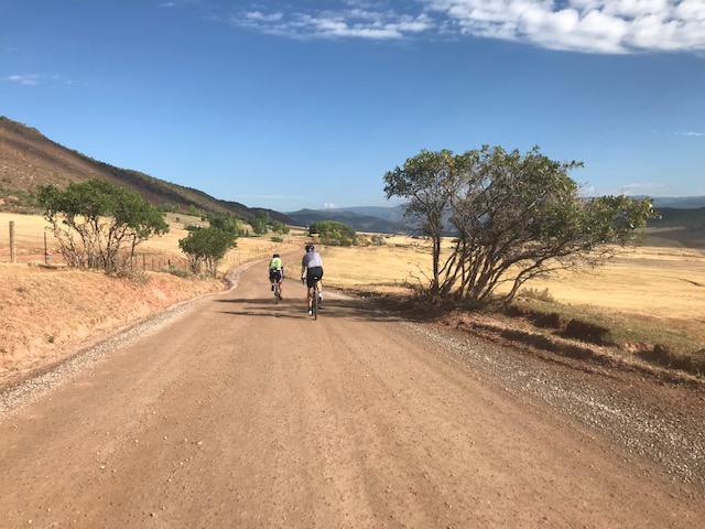
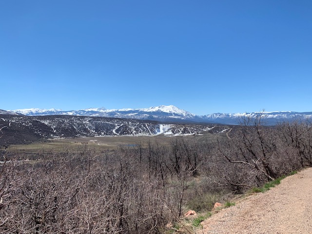
Stay on the same road, pass a small fire station, and climb to the crest of Panorama Ridge. After a short descent, continue straight through the T-intersection. After a bit under a mile, bear left at a Y-intersection and then your first left onto Cottonwood Pass. The pavement ends after about 50 feet, then you are onto a packed roadbase surface. Depending on maintenance schedules, this may be butter-smooth, washboards, or loose chips. Durable road tires are usually fine. From here, it’s a 4-mile climb through ranchland to the south summit. To your right are expansive views of the Elk Range, with Mt. Sopris anchoring the west end of the range. Occasional cattle drives on this road lend their name to the Strava segment for this climb.
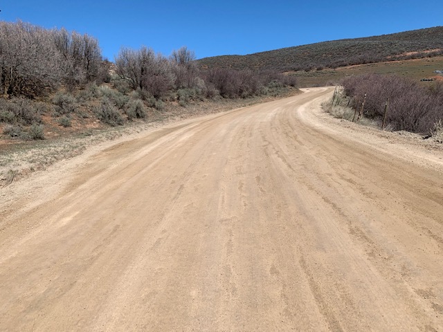
The south summit is a gentle crest, and the surface changes from roadbase to recycled asphalt. This surface will then go all the way to Gypsum, but in some areas is rough and broken, with some potholes. It changes throughout the year, so keep an eye ahead. Descend into a small valley, then climb up steep ramps of 15% through gypsum outcrops to the north summit. From here, it’s a smooth descent to the town of Gypsum. This area is open range, so you may see cattle on the road at different times of year. There are cattle guards and 2 T-intersections, so look ahead. At both intersections, turn left (north).
At the intersection of Highway 6, there are convenience stores to refill bottles and grab a snack. Turn west on Highway 6 to the roundabout, at the western exit of the roundabout you can pick up a bike path. The path will eventually reconnect to Highway 6, then cross under I-70. There is another roundabout, continue straight through it to Glenwood Canyon. The Highway ends at a parking area and the trailhead.
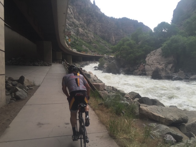
Glenwood Canyon is a beautiful ride, and you are traveling downstream, so it’s pleasant cruise, although afternoon headwinds are common. The canyon cuts down through millions of years’ worth of seafloor redrock deposits, all the way to the basement rock. Watch for traffic as the trail is very popular, and go slow at the tunnels. There are 3 rest areas with bathrooms and water: Bair Ranch, Hanging Lake, and Grizzly Creek. The canyon itself is about 13 miles long.
Exiting the canyon at Horseshoe Bend, the trail again crosses I-70 and ends at the Glenwood Hotsprings Pool. Cross the Colorado River into downtown Glenwood Springs using the pedestrian bridge. There are many restaurants close to the river, most with outdoor seating. Grand Avenue/Highway 82 is a busy road and not recommended, but crossing it at 8th street and heading west 3 blocks will reconnect you to the Rio Grande Trail. From here, it’s about 12 miles back to Carbondale. Stay on the path into Carbondale and the RFTA park-and-ride, cross Highway 133, then stay on the trail to the intersection of 4th street. Turn right, go to 4th and Main, and you will see Roaring Fork Beer Company, adjacent to the small park. Lock your bike and have refreshing and delicious beer.
Dallas’ Gravel Adventure
for .gpx, right-click and save file as… here
83 miles, 6400′. This route came together one day with my other brother Aaron. Of the mid-valley routes, this offers the most gravel, and gravel tires are recommended. It starts off with Dry Park, then returns to Carbondale. At the roundabout, refill bottles at 7-11. Head south on Highway 133 (there is a bike path on the east side of the highway) to Prince Creek, then turn left.
Follow Prince Creek road to the top. This is a hot, dusty, dry climb with ramps up to 15%, so starting with full bottles is critical. There are no refill points until mile 55 (New Snowmass). Once you crest Prince Creek, turn eastward to West Sopris Creek. The descent is often loose gravel, but changes to pavement at the bottom of the grade. There is a long descent down West Sopris, which then climbs at East Sopris Creek over Emma-Roubaix’s gravel section.
The route continues up Old Snowmass to Campground, then the service road to Krabloonik. Once you crest the Divide, you’ll be out of water, but New Snowmass Village and its restaurants await. Eat, drink, and be merry, for you still have 30 miles to get back to Carbondale. Fortunately, this is pretty much all downhill and relatively easy riding on the Rio Grande Trail.